US – West

Seattle, Washington: Redevelopment Project

City: Seattle
Country / US State / US Territory: Washington
Type of Solution: Vacant Properties and Lots
Climate Impact: Extreme Precipitation and Flooding
Social Value Created: recreation; public gathering space; social cohesion; connectivity; employment; benefits vulnerable communities

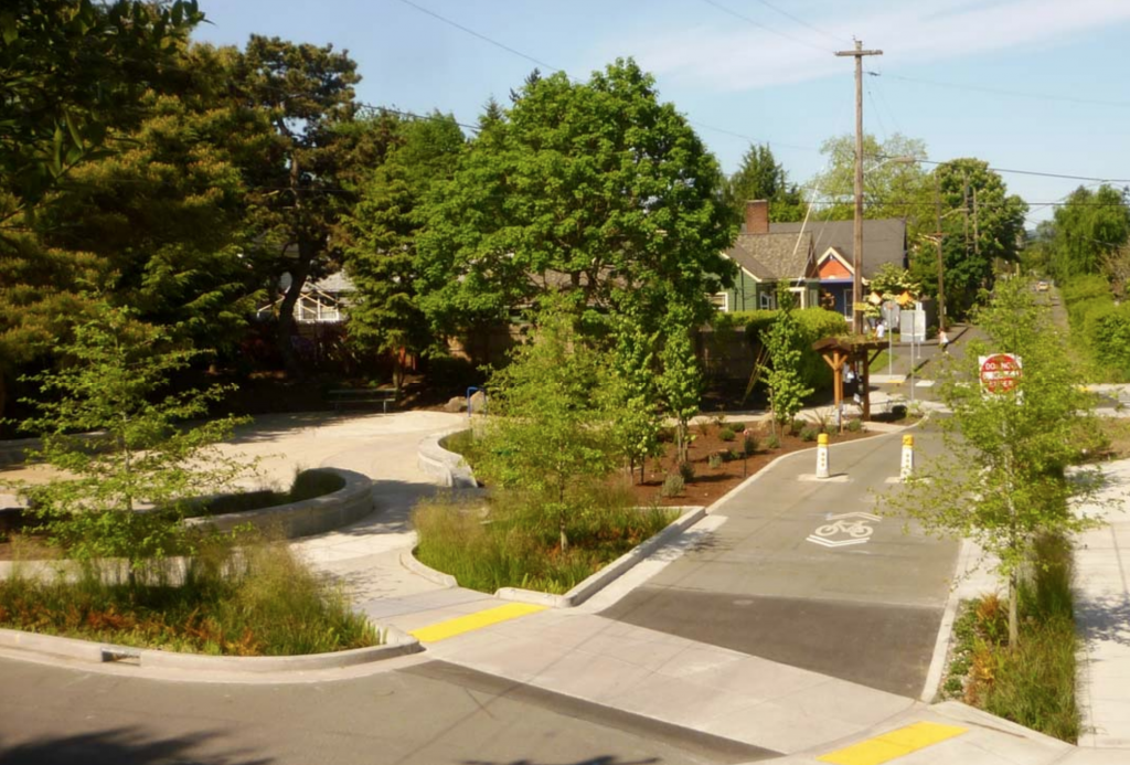
The City of Seattle recently redeveloped undertook a nine-acre redevelopment project to repurpose an underutilized parking lot and the surrounding area. The Thornton Creek restoration is one component of the restoration project. Thornton Creek was previously been forced below the surface as the urban area developed.

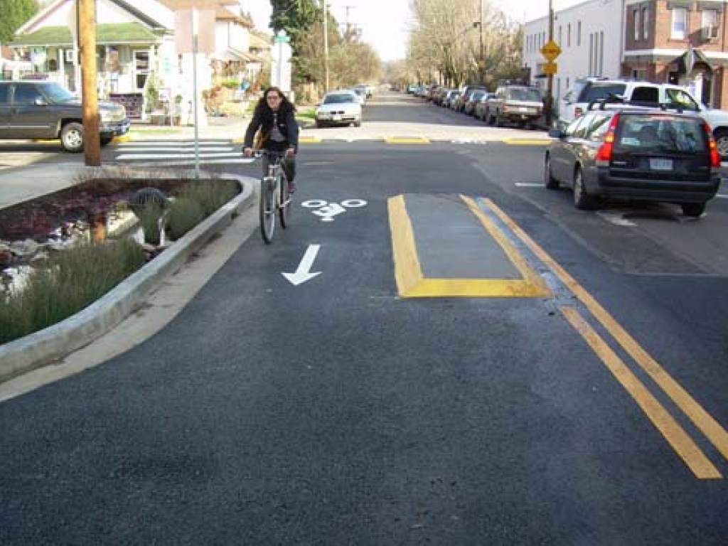
The restoration project aimed to restore the creek to manage stormwater runoff from 680 acres. Impervious surfaces were also reduced by 78%, improving ground water infiltration and thereby reducing runoff. Native species were used for 85% of the project’s landscaping, reducing water consumption for landscaping and reducing maintenance needs. The project design also improves stormwater filtration to remove pollutants from stormwater runoff, removing 40-80% of total suspended solids from 91% of runoff in the 680 acre drainage basin.

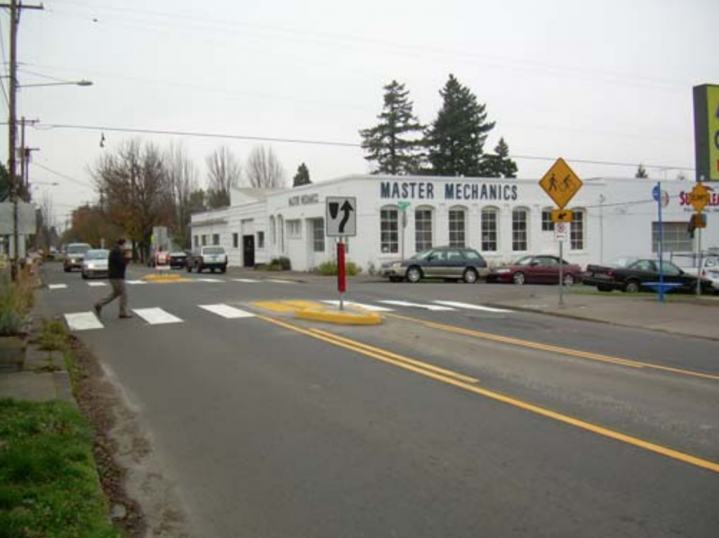
Thornton Place is a combined residential and commercial space created in the redevelopment. The project added 530 units of mixed-income housing and 50,000 square feet of retail space, including 143 units of assisted-living housing for seniors. Thornton Place also includes a 14-screen cinema and a plaza area for public gatherings. Additionally, pedestrian links were created to link adjacent commercial and residential neighborhoods, improving walkability. Transit access was also improve by the design, increasing mobility and diversity of transportation.

Sources:
Benfield, K. (June 6, 2011). How to turn a parking lot into an ideal green community. The Atlantic. Retrieved from https://www.theatlantic.com/national/archive/2011/06/how-to-turn-a-parking-lot-into-an-ideal-green-community/239973/.

Benfield, K. (June 7, 2011). A seattle redevelopment that is greener than green. Grist Magazine. Retrieved from https://grist.org/urbanism/2011-06-06-seattle-urbanism-transit-state-of-the-art-green-mixed-planning/.

Seattle, Washington: Elevated Floating Bridge

City: Seattle
Country / US State / US Territory: Washington
Type of Solution: Bridge
Climate Impact: Hurricanes and Extreme Storms
Social Value Created: Diverse Transportation; Public Health and Safety; Active Living and Recreation

The Washington State Department of Transportation (WSDOT) is completed reconstruction of the Evergreen Point (SR 250) floating bridge spanning Lake Washington in April 2016. The bridge is the longest floating bridge in the world. Floating bridges are support by large, water-right concrete pontoons. The bridge was reconstructed to withstand that anticipated increase in wind loads from more frequent extreme storms and hurricanes. Stronger winds may result in bridge failure by breaking the drawspan, anchor cables, or pontoons.

The new bridge design has also addressed anticipated increases in traffic congestion by increasing the width of the lands and adding a transit/High Occupancy Vehicle (HOV) lane. Additionally, there will be a new 14-foot-wide bicycle and pedestrian path that connects to recreational trails, improving recreation and increasing diversity of transportation options for commuters. The new design include flexibility for the City to add on a light rail in the future, also supporting diverse transportation options.

Sources:
Washington State Department of Transportation. (n.d.). SR 520 bridge replacement and HOV program – floating bridge facts. Retrieved from https://www.wsdot.wa.gov/Projects/SR520Bridge/About/BridgeFacts.htm.

Seattle, Washington: Elliott Bay Seawall Project

City: Seattle
Country / US State / US Territory: Washington
Type of Solution: Seawall and Living Shorelines
Climate Impact: Seal Level Rise
Social Value Created: Diverse Transportation; Public Health and Safety; Active Living and Recreation

The City of Seattle recently finished replacing an aging seawall located in Elliot Bay in 2017 that was built between 1916 and 1934. Due to risk of failure during an earthquake, a new sea wall is being constructed with a 75 year lifespan. Under advisement from the University of Washington’s Climate Impacts Group (CIG), the Seattle Department of Transportation (SDOT) is constructing a seawall using the low-probability, high-impact estimate for sea level rise, i.e. the worst projected scenario for 2100. The seawall not only protects against sea level rise, inundation, and coastal erosion, but it also supports a diverse transportation network.

The sea wall supports a highway, a ferry terminal, rail lines, biking, and walking. A pedestrian promenade and a two-way cycle track are being constructed to improve walkability and bikeability. Additionally, the seawall is designed to improve and recreate a natural aquatic shoreline habitat, such as glass blocks in the sidewalk to allow light penetration to the water below and salmon migration pathways. The project also includes reconstruction of two public piers and construction of new parks and recreational pathways.

Sources: pegNielsen. (April 23, 2014). More than just a seawall habitat: Enhancing habitat in the Elliott Bay and preserving public safety (Blog post). Retrieved from http://sdotblog.seattle.gov/2014/04/23/more-than-just-a-seawall-enhancing-habitat-in-elliott-bay-and-preserving-public-safety/.

Seattle Office of the Waterfront and Civic Projects. (n.d.). Seawall. Retrieved from https://waterfrontseattle.org/seawall.

The Adaptation Clearinghouse. (March 18, 2016). Seattle, Washington Department of Transportation (Seattle DOT) Elliott Bay Seawall Project. Retrieved from http://www.adaptationclearinghouse.org/resources/seattle-washington-department-of-transportation-seattle-dot-elliott-bay-seawall-project.html.

San Francisco, California: Baylands Restoration

City: San Francisco
Country / US State / US Territory: California
Type of Solution: Habitat Restoration
Climate Impact: Seal Level Rise; Hurricanes and Storm Surge; Extreme Precipitation and Flooding
Social Value Created: Community Engagement; Employment Opportunities; Water Security and Quality; Property Values; Active Living and Recreation; Urban Beautification

San Francisco has set a goal to restore 100,000 acres of the bay’s tidal marshes. A 2015 study projects that most of the existing marshes will be damaged or destroyed by 2100. The City has identified restoration of marshes as a strategy for managing sea level rise, as it provides the community with other socially value co-benefits unlike other sea level rise solutions.

Through restoration initiatives and innovative strategies, marshes can be restored and enhanced to prepare for sea level rise and coastal flooding. Additionally, the marshes help to filter pollutants out of runoff to improve water quality, and they provide habitat for many at-risk species and species critical to the economy, such as Dungeness crab and salmon. Further, restoration projects help to control coastal erosion of water front properties.

Sonoma Land Trust acquired 1,000 acres of tidal marshes in the Sears Point Wetland along the northern shore of San Francisco Bay. For the project, 285 feet of an existing levee was breached to restore previous marsh land, creating a “habitat” levee using marsh mounds, or raise “islands”. 500 marsh mounds were constructed, each of which are 6 feet tall and 50-75 feet wide, using reclaimed sediment. These mounds support marsh accretion and provide cover for nesting birds from the rising tides and waves during storms. The “habitat” levee both protects the adjacent a nearby highway and railroad and provides additional wildlife habitat.

The project also includes the development of a 2.5 mile section of the Bay Trail, a recreational trail running through the marshes. This addition will provide users with views of Mt. Tamalpais, Mt. Diablo, and the San Francisco skyline, as well as include new benches, interpretive signs, and parking.

South Bay Salt Pond Restoration Project is another project underway, seeking to restore 15,100 acres of former commercial salt ponds to functional tidal marshes. The Project is will manage coastal flooding, as well as improve wildlife habitat and increase public recreational access. A 400 foot berm will be constructed to help control flooding. 16 islands, each 15,000 square feet, will also be constructed. Levees will also be lowered and breeched to restore 130 acres of tidal pools.

In addition to flooding control measures, public recreational trails will be realigned and resurfaced to improve public access, and two overlooks and four interpretive panels will be installed.

Environmental Protection Agency. (n.d.). South Bay Salt Pond Tidal Marsh Restoration at Pond A17 Project. Retrieved from https://www.epa.gov/sfbay-delta/south-bay-salt-pond-tidal-marsh-restoration-pond-a17-project.

Small-Lorenz, S. L., Stein, B. A., Schrass, K., Holstein, D. N., & Mehta, A. V. (2016). Natural defenses in action: harnessing nature to protect our communities. National Wildlife Foundation, Washington, D.C. Retrieved from https://www.nwf.org/~/media/PDFs/Global-Warming/Reports/NWF_Natural-Defenses-in-Action_Report.pdf.

Sonoma Land Trust. (June 6, 2014). Sonoma Land Trust and Ducks Unlimited kick off construction of Sears Point 960-Acre Wetland Restoration Project on San Pablo Bay. Retrieved from https://www.sonomalandtrust.org/news_room/press_releases/1406-sears-point.html.

Sonoma Land Trust. (n.d.). Seas Point Wetland Restoration Project groundbreaking FAQs. Retrieved from https://sonomalandtrust.org/news-room/jenner-information-kit/faq/.

South Bay Salt Pond Restoration Project. (n.d.). Project description. Retrieved from http://www.southbayrestoration.org/Project_Description.html.

Wood, J., Pitkin, M., Meisler, J., DiPietro, D., Graffis, A., & Fris, R. (January 17, 2018). Saving tidal marshes in the San Francisco Bay. U.S. Climate Resilience Toolkit. Retrieved from https://toolkit.climate.gov/case-studies/saving-tidal-marshes-san-francisco-bay.

San Diego, California: Water Conservation Home Makeover at Chollas Creek

City: San Diego
Country / US State / US Territory: California
Type of Solution: Buildings and Housing
Climate Impact: Drought
Social Value Created: Community Engagement; Public Education; Public Health and Safety; Food Security and Nutrition; Water Security and Quality; Social Justice and Equity for Vulnerable Communities
Cost: $524,000

The Water Conservation Home Markover is a pilot project that helped neighborhoods facing issues with water and food security, many of which were Spanish speaking residents, with water conservation renovations. These renovations helped to reduce water consumption, as well as improve stormwater management. Homes were retrofitted with gray water systems, low-flow fixtures, and sink aerators. Additionally, rail barrels were installed and residents were provided with a pallet of drought tolerant landscaping plants and a low-water fruit tree, providing additional access to fresh, healthy foods.

The project also support community education. Participating residents are quarterly sent reports detailing the amount of water saved, energy saved, and carbon sequestration resulting from the project. Additionally, local schools feature the project in classroom lessons and take field trips to see the projects. An outdoor climate action center was also donated to the Millennial Tech Middle School by local landscape architects, providing a space for students to learn about drought tolerant landscaping.

Sources:
Atlas. (n.d.). Water Conservation Home Makeover at Chollas Creek. Retrieved from https://www.the-atlas.com/project?id=350.

San Diego, California: Environmental Health Coalition

City: San Diego
Country / US State / US Territory: California
Type of Solution: Awareness Campaign / Community Outreach and Education Program
Climate Impact: Extreme Temperatures and Urban Heat Island Effect; Air Quality; Extreme Precipitation and Flooding
Social Value Created: Community Engagement; Public Education; Public Health and Safety; Equitable Services and Access; Social Justice and Equity for Vulnerable Communities

The Environmental Health Coalition is a community-based organization focusing on bringing climate justice to low-income communities of immigrants and refugees in San Diego, California. The program has developed bilingual education materials, such as brochures, posters, and promotoras, about air pollution, climate change, and climate impacts. These materials focus on solutions community members can implement that will also save money.

EHC has also facilitated the development of a climate action plan for these communities, focusing on transportation justice, energy justice, good jobs, climate change resilience, and bold goals, state, and local climate laws.

Fig: Example of a sign used to communicate the health risks of climate change

Sources

Rudolph, L. Gould, S., & Berko, J. (2015). Climate change, health and equity: opportunities for action. Public Health Institute, Oakland, CA. Retrieved from http://www.phi.org/uploads/application/files/h7fjouo1i38v3tu427p9s9kcmhs3oxsi7tsg1fovh3yesd5hxu.pdf.

Portland, Oregon: Green Streets Program

City: Oregon
Country / US State / US Territory: Portland
Type of Solution: City Government Program, Streets
Climate Impact: Extreme Temperatures and Urban Heat Island Effect; Air Quality; Heavy Precipitation and Flooding
Social Value Created: Water Security and Quality; Diverse Transportation; Public Health and Safety; Active Living and Recreation; Community Engagement; Educational and Career Development Opportunities; Community Wellness and Quality of Life

The City of Portland, Oregon, created the Green Streets Program in 2003. The program seeks to improve stormwater management around city streets to reduce flooding, sewer backups, and combined sewer overflows during heavy precipitation events. Additionally, the strategies implemented help to address issues of air quality and extreme temperatures. The program also has a strong focus on social value creation through improvements in walkability and bikeability, creation of urban green space, public health, and job creation.

SE Spoke Street is an example of one street that was renovated. Safety was improved through the addition of bike lanes, pedestrian refuge islands, channelizer islands, and speed bumps. SW Texas Street utilized green infrastructure to improve stormwater management, building swales and restoration of an adjacent wetland area. Local residents led the effort to ensure that the project met their needs and contributed to their overall quality of life.

On NE Holman Street, a pocket park was constructed through a collaboration between the U.S. Environmental Protection Agency, Portland Bureau of Environmental Services, Portland Parks & Recreation, Portland Bureau of Transportation, and Portland Water Bureau. The park will help to control flooding and filter pollutants from runoff. Catchment areas were included in the park for drainage, and pedestrian and bicycle safety features were incorporated into the street design. Community members also engaged in the design process, resulting in more seating and an informational kiosk.

Portland’s Bureau of Environmental Services engaged community members in the initiative through the creation of the Green Street Steward program. The program allows community members to volunteer to help clean the streets and maintain landscaping.

Fig: Bicycle (left) and pedestrian (right) safety features installed on SE Spoke Street (Photos retrieved from https://www.portlandoregon.gov/bes/article/302372)

Fig: Swales installed along SW Texas Street (Photo retrieved from https://www.portlandoregon.gov/bes/article/173493)

Fig: NE Holman Street Pocket Park (Photo retrieved from https://www.portlandoregon.gov/bes/article/408707)

Sources

The Adaptation Clearinghouse. (2007). Portland, Oregon Green Streets Program. Retrieved from http://www.adaptationclearinghouse.org/resources/portland-oregon-green-streets-program.html.

The City of Portland, Oregon. (n.d.). Holman Pocket Park and Green Street Bicycle Boulevard Project. Retrieved from https://www.portlandoregon.gov/bes/article/408707.

The City of Portland, Oregon. (n.d.). SE Spokane Green Street Bicycle Boulevard Project. Retrieved from https://www.portlandoregon.gov/bes/article/302372.

The City of Portland, Oregon. (n.d.). SW Texas Green Street Stormwater Improvements. Retrieved from https://www.portlandoregon.gov/bes/article/173493.

Phoenix, Arizona: Resilience AmeriCorps

City: Phoenix
Country / US State / US Territory: Arizona
Type of Solution: Volunteer / Community Group
Climate Impact: Extreme Temperatures and Urban Heat Island Effect; Air Quality; Extreme Precipitation and Flooding
Social Value Created: Social Justice and Equity for Vulnerable Communities; Community Engagement; Public Education; Diverse Transportation; Public Health and Safety; Urban Beautification; Community Wellbeing and Quality of Life

The City of Phoenix is participating in the national Resilience AmeriCorps program. The local program is called Resilient PHX. Volunteers assist low-income communities with projects to build community capacity. Resilient PHX has already completed a number of projects, such as Grandview Message Boards, Grand Avenue Curb Cut/Rain Garden, and Triangle Tree Planting.

Three message boards were installed in the Grandview Neighborhood to improve communication of climate risks, such as the risks of extreme heat in vulnerable communities, specifically low-income residents, elderly residents, and renters.

Another project was the Grand Avenue Curb Cut/Rain Garden. The curb cut/rain garden improves stormwater management to prevent flooding risks during heavy precipitation events. In addition to improved stormwater management, the project created more greenspace for residents and improved aesthetics, walkability, and shade coverage.

Lastly, the Triangle Tree Planting project was a community outreach program that engaged residents in tree planting and taught residents tree maintenance in an effort to mitigate extreme heat and the heat island effect. Trees increase shade coverage, which also contributes the the walkability of the area.

Sources: City of Phoenix. (n.d.). Resilient PHX. Retrieved from https://www.phoenix.gov/volunteer/resilient-phx.

Phoenix, Arizona: Civic Space Park

City: Phoenix
Country / US State / US Territory: Arizona
Type of Solution: Park
Climate Impact: Extreme Temperatures and Urban Heat Island Effect; Air Quality; Extreme Precipitation and Flooding
Social Value Created: Public Space; Social Cohesion; Diverse Transportation; Connectivity; Active Living and Recreation; Arts and Culture

Phoenix, Arizona is a classic example of urban sprawl. The city is already facing issues with extreme temperatures, which is further amplified by the urban heat island effect. Civic Space Park is a 2.7 acre park located in Phoenix that includes green space with trees to mitigate extreme temperatures and provide shade for residents. Solar panels producing 75 kilowatts of renewable energy provide additional shade. Also, the green infrastructure improves stormwater management, which is helpful during monsoon season.

Not only is the park helpful in managing climate risks, but the park is a public space contributing the social cohesion and providing a number of other social benefits. The park features a number of artistic featurings, including a nighttime lighting show simulating lightning during a monsoon and an art installation, titled, “Her Secret is Patience.” This title arose from a phase used by Ralph Waldo Emerson that was inspired by elements of Arizona nature. There is also an interactive water feature, providing a playspace for children and adults.

The park promotes recreation and leisure, providing a turf landscape in the southwest corner of the park with pedestrian-scale retaining walls, game tables, benches, and densely spaced shade trees. The site is also located adjacent to the METRO Light Rail, increasing access to the park through improved connectivity and promoting diverse transportation.

Fig: Birds eye view of Civic Space Park (Photo retrieved from http://worldlandscapearchitect.com/civic-space-park-phoenix-usa-aecom/#.W1HvvdJKiUk)

Fig: LED lights with nighttime lighting show (Photo retrieved from http://worldlandscapearchitect.com/civic-space-park-phoenix-usa-aecom/#.W1HvvdJKiUk)

Fig: Interactive water feature with the “Her Secret is Patience” art installation above (Image retrieved from http://worldlandscapearchitect.com/civic-space-park-phoenix-usa-aecom/#.W1HvvdJKiUk)

Source: AECOM. (July 23, 2013). Civic Space Park, Phoenix USA. World Landscape Architecture. Retrieved from

*Note: This case was documented from an interview with a city practitioner.

Los Angeles, California: Green Alley

City: Los Angeles
Country / US State / US Territory: California
Type of Solution: Alleyway
Climate Impact: Extreme Temperatures and Urban Heat Island Effect; Air Quality; Extreme Precipitation and Flooding
Social Value Created: Connectivity; Diverse Transportation; Public Health and Safety; Community Engagement; Social Cohesion; Arts and Culture; Public Education and Awareness

Los Angeles has over 900 of miles of alleys that are often used for dumping and experience high instances of crime. The Trust for Public Land Climate Smart Cities program is a national program for assisting cities in projects to mitigate and adapt to climate change. The Avalon Green Alley Demonstration project repurposed a mile of underutilized alleyways in South Los Angeles into green alleys.

The Trust for Public Land Climate Smart Cities collaborated with the City of Los Angeles, UCLA, and Arizona State University to create green alleys in South Los Angeles. These green alleys improve air quality and contribute to urban cooling, mitigating extreme temperatures and the urban heat island effect.

The green alley also helps to filter pollutants from stormwater runoff and control stormwater, mitigating flooding and recharging the groundwater. Additionally, the repurposed alleyways provide recreational space and improve the walkability and bikeability of the area. The green alley creates a safe passageway between various key destinations in the area, including a grocery store and nearby schools. The safe passageway improves community connectivity.

A volunteer group, Equipo Verde (Green Team), manages the green alley, organizing volunteer days, picking up garbage, and landscaping and planting trees. The group improves community engagement and educates the local community on the importance of managing these alleyways.

Fig: The Green Alley Demonstration Project completed by The Trust for Public Land (Retrieved from https://www.tpl.org/green-alleys#sm.0000ca4mkgzx8en8zd02b2m3nuov7)

Fig: Members of Equipo Verde working on the landscaping in the green alley (Retrieved from https://www.tpl.org/verde#sm.0000ca4mkgzx8en8zd02b2m3nuov7)

Sources: The Trust for Public Land. (March 17, 2016). Meet the Equipo Verde: allies for alleys. Retrieved from https://www.tpl.org/verde#sm.0000ca4mkgzx8en8zd02b2m3nuov7.

The Trust for Public Land. (n.d.). Green alleys. Retrieved from https://www.tpl.org/green-alleys#sm.0000ca4mkgzx8en8zd02b2m3nuov7.